|
What is G.I.S.?
Unlike a typical map, which shows
only spatial data such as roads,
cities, and country borders, a GIS
links attribute data such as
population statistics to the spatial
data in a map. This link provides
the ability to analyze spatial data,
letting you use map data in a whole
new way. After you have worked with
the map and the data to specify what
you want to display, you can copy
the current map view into a report
or print it, giving your reports and
presentations greater impact and
clarity.
Interactive GIS map
https://nwarpc.maps.arcgis.com/apps/webappviewer/index.html?id=d6190714fbd649e3ad3f425af58462e5
Interactive lookup of parcels VIA Benton County GIS Specific map types
in PDF format.
Lowell Planning Area Map 2016
Lowell Street Map
Zoning Map
Future Land Use Map
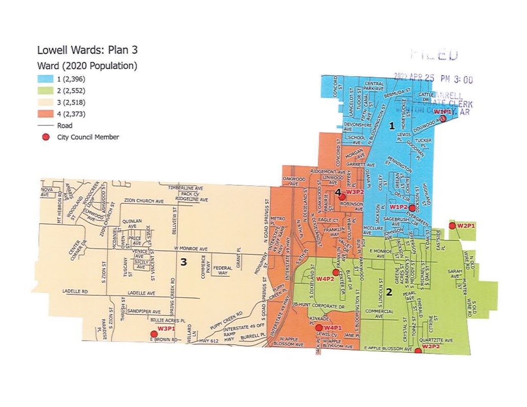
Alderman Wards
Street Map
2024 Master
Street Plan
|
New Page 1
Contact Us!
216 N Lincoln St
Lowell, AR 72745
479-770-2185
|

